Hiking ME

Hiking ME Logo

Exploring Maine one hiking trail at a time

Traveller Mountain Loop Trail, Baxter State Park

Facebook Icon Instagram Icon Youtube Icon Podcast Icon TikTok Icon

Acadia National Park

Map

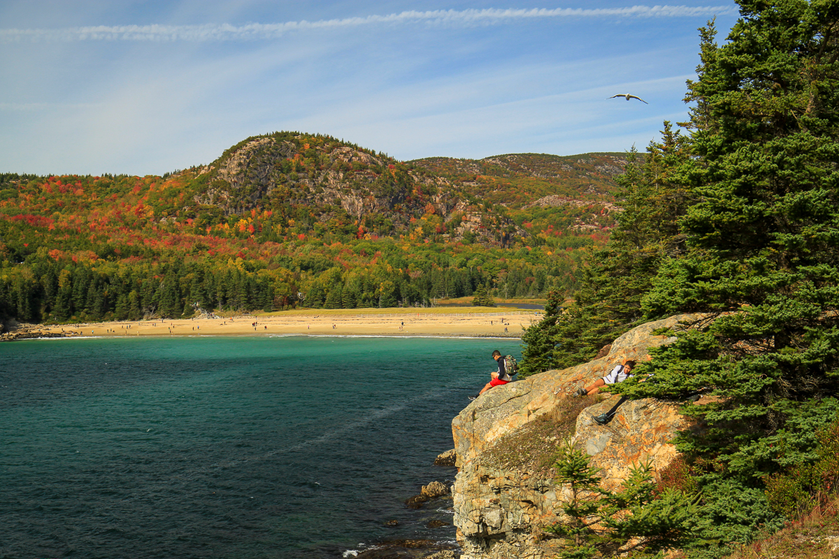
Acadia National Park is the second most visited park in the country with over two million visitors a year. There are a few areas where you will find most of the visitors. Anywhere around Sand beach, the Jordan Pond Tea House or Cadillac Mountain peak are usually packed with people. If you are planning to hike trails in these areas make sure you get there early or learn to use the bus system. The amazing thing is that the number of people drops quickly as you hike outside of these areas.

If you are planning to hike in the park we highly suggest using the free bus system. After driving around the park for several hours looking for a parking spot we learned how to use it. Using the buses means you don't have to worry about finding a parking space at the trail head. You also won't have to walk a long distance from where you parked to get to the trail head. Just make sure you learn the schedule. We were late for the last bus on our Bubbles hike and had to walk down the road towards Jordan Pond to catch a later bus at another bus stop.

Galleries

Acadia National Park pictures

Trails in the Park

  • Acadia Mountain Trail
  • Alder Trail
  • Amphitheatre Trail
  • Anvil Trail
  • Asticou and Jordan Pond Path
  • Bald Peak Trail
  • Bar Island Access Trail
  • Bass Harbour Head Lighthouse Access Trail
  • Beech Cliff Loop Trail
  • Beech Mountain Trail
  • Beehive Trail
  • Bernard Mountain Trail
  • Bowl Trail
  • Bubbles Trail
  • Bubbles Divide Trail
  • Buck Cove Mountain Trail
  • Cadillac Mountain Trail
  • Cadillac Summit Loop Trail
  • Cadillac West Face Trail
  • Canada Cliffs Trail
  • Canon Brook Trail
  • Carriage Roads
  • Champlain Mountain Trail
  • Cold Brook Trail
  • Compass Harbour Trail
  • Deer Brook Trail
  • Dorr Mountain Trail
  • East Trail
  • Eagles Cragg Trail
  • Eagle Lake Trail
  • Flying Mountain Trail
  • Giant Slide Trail
  • Gilley Trail
  • Gorge Path
  • Gorham Mountain Trail
  • Grandgent Trail
  • Great Head Trail
  • Great Meadow Loop
  • Great Notch Trail
  • Hadlock Brook Trail
  • Hadlock Ponds Trail
  • Hemlock Road Loop
  • Hunters Beach Trail
  • Jesup Path
  • Jordan Pond Carry Trail
  • Jordan Cliffs Trail
  • Jordan Pond Path
  • Kebo Brook Trail
  • Kebo Mountain Trail
  • Ledge Trail
  • Long Pond Trail
  • Lower Norumbega Trail
  • Man o'War Brook Trail
  • Mansell Mountain Trail
  • Maple Spring Trail
  • Norumbega Mountain Trail
  • Ocean Path
  • Orange and Black Trail
  • Otter Cove Trail
  • Parkman Mountain Trail
  • Pemetic Mountain Loop
  • Penobscot Mountain Trail
  • Perpendicular Trail
  • Precipice Trail
  • Quarry Trail
  • Razorback Trail
  • Saint Sauveur Mountain Trail
  • Sargent Mountain Trail
  • Schiff Path
  • Schoodic Head Trail
  • Schooner Head Point Trail
  • Ship Harbour Trail
  • Sluiceway Trail
  • Valley Trail
  • Valley Cove Trail
  • Valley Peak Trail
  • Western Mountain Connector Trail
  • West Ledge Trail
  • Wonderland Trail
  • Directions

    Acadia park is a large park that covers the majority of Mount Desert Island. The park is bisected by several main roads offering many different access points. Travel south on Route 3 from Ellsworth to get to Mount Desert Island. Once you cross the causeway to Mount Desert Island you can continue on route 3 to go to Bar Harbor and access the eastern section of the park, or continue straight on route 198 towards Southwest Harbour to access the western section of the park.